
Does any place give you a feeling that you are standing at the end of the world? As the sun reached its noon mood, the white sand and the rocks, connecting miles of forest to the blue green ocean, put us to think about the map where we were then. When you check the Cabo Blanco Absolute Natural Reserve on the map, you will find it at the farthest southern tip of the Nicoya peninsula, which looks like an arm on the western end of Costa Rica.
Apart from having a historical significance, this natural reserve has interesting trails. You will find abundant flora and fauna along all the trails and spectacular views at the end of its longest trail. Read on to find out more about our hiking experience in the reserve.
The History of Cabo Blanco Absolute Natural Reserve
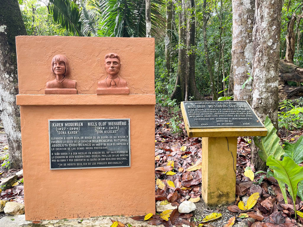
Cabo Blanco Absolute Natural Reserve or Reserva Natural Absoluta Cabo Blanco boasts of being the nation’s first nature reserve. The reserve has gone in the pages of history for being the first protected area among the many efforts of conservation that the country has achieved over the years.
Before the formation of the current reserve in 1963, the land was used for agriculture. Swedish Nationals, Karen Mogensen and Olof Wessberg, who made the Nicoya Peninsula their home in the 1960s, helped grow this 3000+ acre nature reserve. They realized the potential of the area to put up rich biodiversity and hence began the efforts to help nature take its own course.
Schedule and Entrance Costs
Schedule
The park is open between 8am – 4pm, all days of the week, except Mondays and Tuesdays. If you are planning to go for the Sueco Trail, you will need to arrive before 12 pm.
Entrance Costs
The entrance costs to the natural reserve are as listed below. Tax will be added to the price.
For foreign nationals:
- Adults: 12 USD
- Children, less than 12 years: 5 USD
For citizens and residents:
- Adults: 1600 CRC
- Children, less than 12 years: 500 CRC
Parking
There is a parking area near the entrance, which does not require any additional cost.
How to reach the Cabo Blanco Natural Reserve?
The Cabo Blanco Absolute Natural Reserve is located at the southern tip of the Nicoya Peninsula. To reach the southern part of Nicoya peninsula, you can can drive down from Liberia or you can drive from San Jose but take a ferry in between to cross the Gulf of Nicoya. You can take your vehicle in the car.
One end of the Cabo Blanco Natural Reserve touches the Mal Pais town on the west coast. But there is no entrance to the trails from this end.
Although you cannot access the trails of the nature reserve on the Mal Pais side, from here, you can visit the beach, Playa Cuevas, which is a small part of the Cabo Blanco Natural Reserve. Read the Playa Cuevas section for more details.
The entrance to the hiking trails of the reserve is through a small town called Cabuya. It is a half an hour drive from Mal Pais or Montezuma, whichever route you plan to take.
Mal Pais to Cabo Blanco Natural Reserve
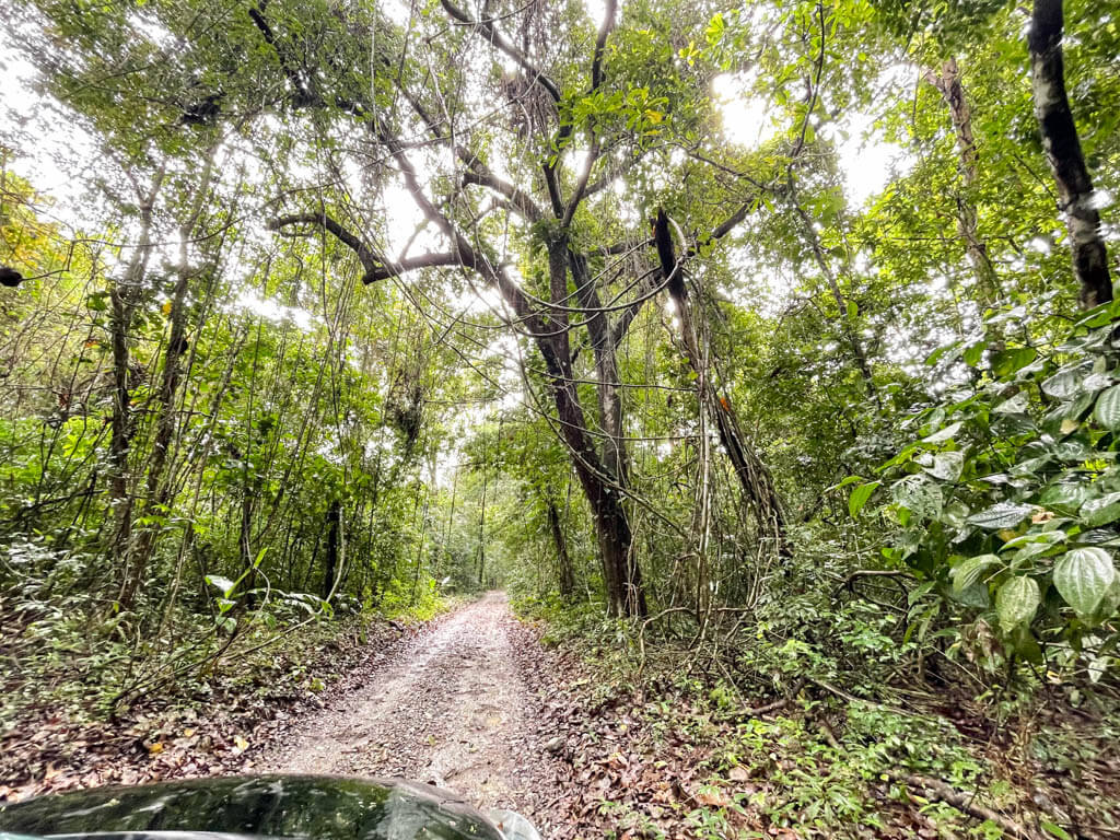
The road from Mal Pais to Cabuya requires a 4X4. There are 3 sections where the unpaved road is submerged in flowing rivers. It gets tricky in the rainy season or even if it rained the night before during the dry season.
We did try this adventure though in a non 4X4 vehicle, crossing the three hours, but in the dry season period of late December.
For a drive with lesser thrill, you will need to go to the Cobano town. A prominent right turn from the town center leads to Cabo Blanco, via Montezuma.
Montezuma to Cabo Blanco Natural Reserve
Montezuma to Cabuya is an easier drive. Although unpaved, you can drive without any obstacles, if you do not mind the occasional potholes in certain sections.
Cabo Blanco Absolute Natural Reserve: Hiking Trails
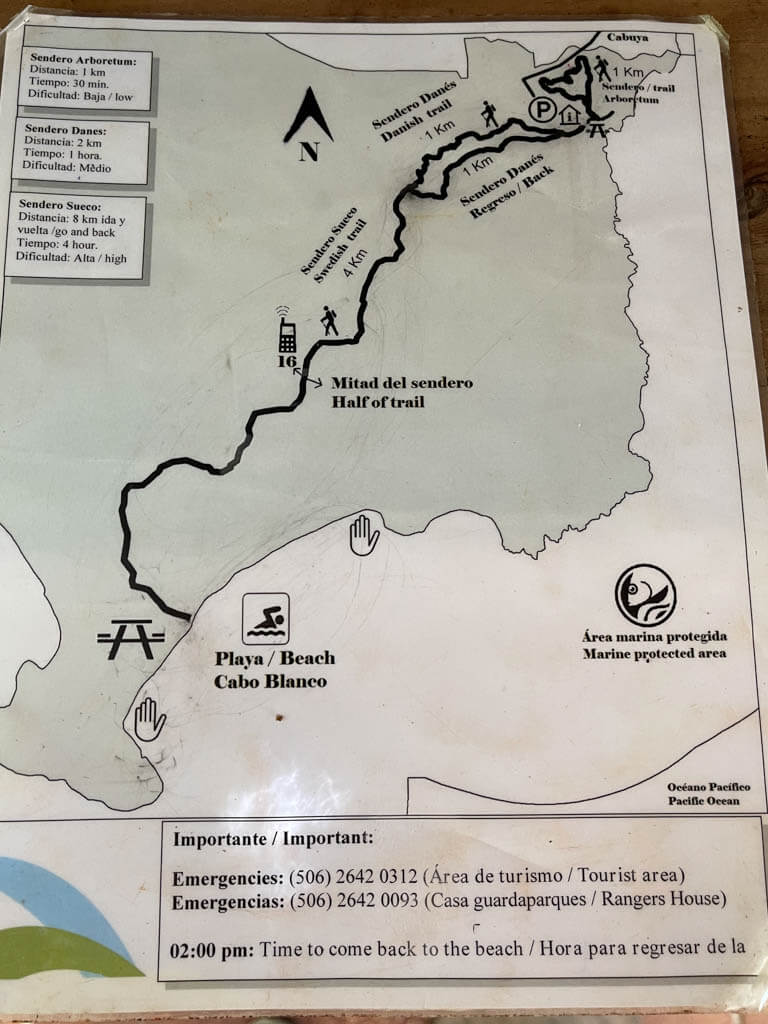
The reserve has 3 trails, that can explored by the visitors.
- Danes Trail/ Danish Trail
- Sueco Trail/ Swedish Trail
- Arboretum Trail
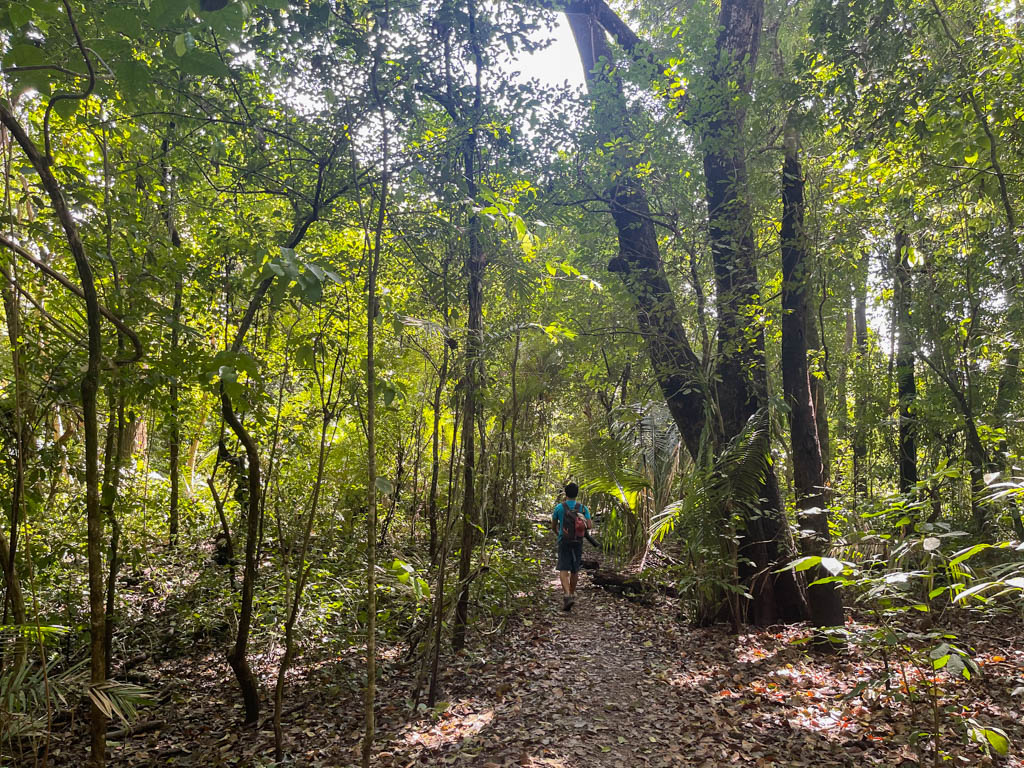
Danes Trail / Danish Trail
Trail Information
The 2 km (1.2 miles) Danes trail (or Danish Trail) is a circular trail, which is divided into two 1 km stretches. The directions suggest to start specifically at one end and another for coming back (Regreso trail). However, it does not matter much whichever end you start.
Trail Experience
The trail starts near the entrance. There are concrete steps in most parts of this trail which makes it easier to walk. There are several uphill and downhill sections on the trail so it can be bit strenuous on a hot day. However if you are just hiking this 2 km trail, it should be fine. This is perfect to explore the flora and fauna of the nature reserve at an easier pace.
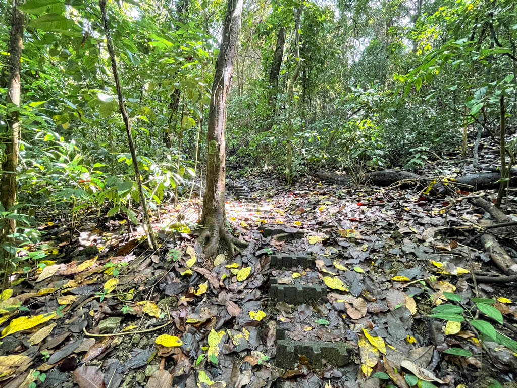
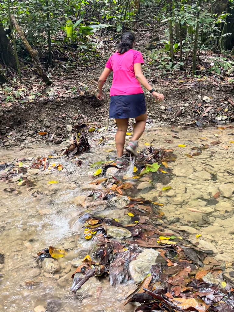
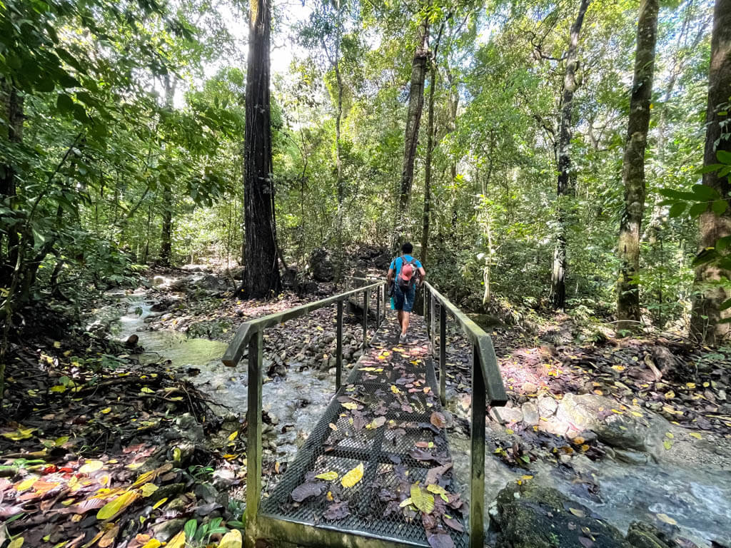
At one point, the trail disappeared in a stream. We were wondering if that is the way to go, as there was no bridge and there was a chance that the water flows over our hiking shoes. However, we found a small sign that said Danes trail and we realized that, despite the flowing river, that was indeed the way to go. So, expect this river-crossing in an otherwise paved trail.
Wildlife
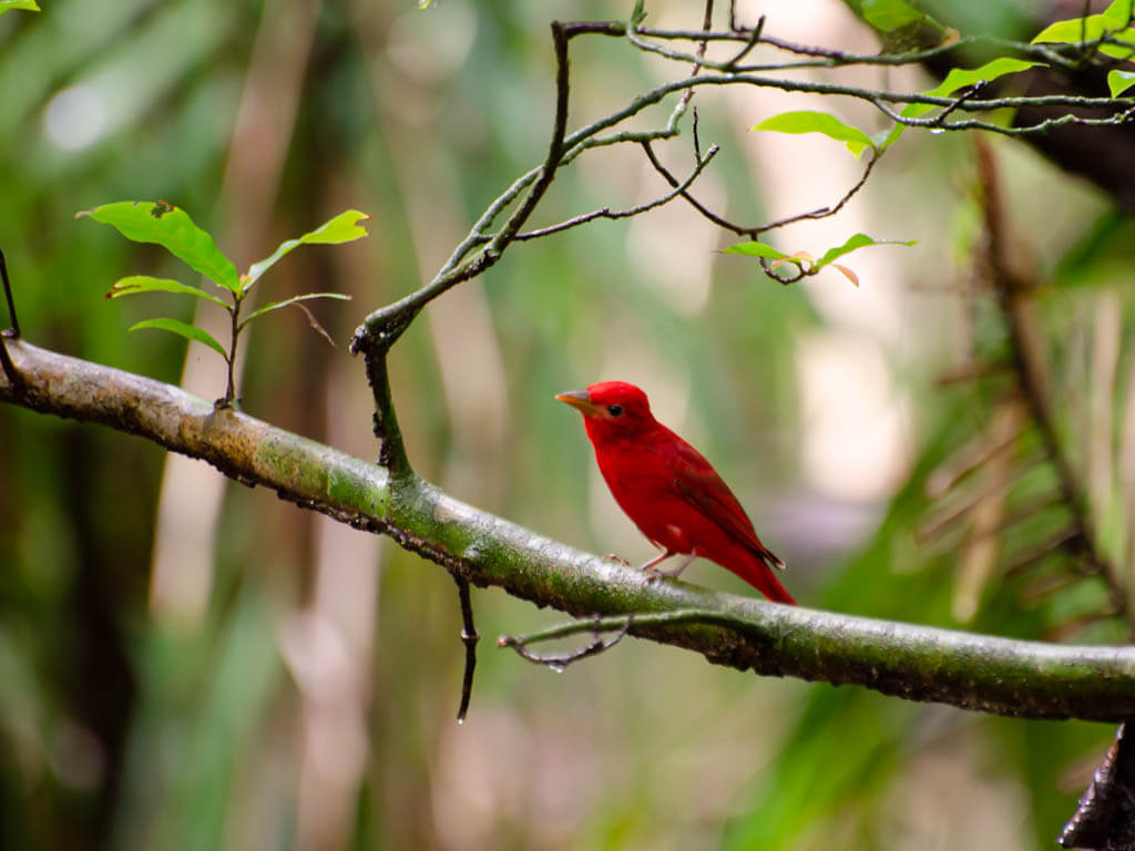
We saw many species of birds on this trail. In fact, we found a summer tanager at the very start of our hike.
Sueco Trail / Swedish Trail
Trail Information
The Sueco Trail is about 4 km (2.5 miles) one way, and starts at the 1 km end of the Danes trail. So you will need to walk the first half of the Danes trail to find the entrance to the Sueco Trail. This makes the total hike of the Sueco trail, 5 km (3 miles) from the entrance of the reserve. So. the return trip hike is 10 km (6 miles).
Trail Experience
The trail is moderate / difficult not just because of the distance, but it has multiple uphill hikes. The humid conditions do not help either. However, you are rewarded with the long white sand Cabo Blanco beach at the end of the trail. Also, the chances of wildlife spotting is fairly high, given the secluded nature of the reserve and not many visitors venture on this trail.
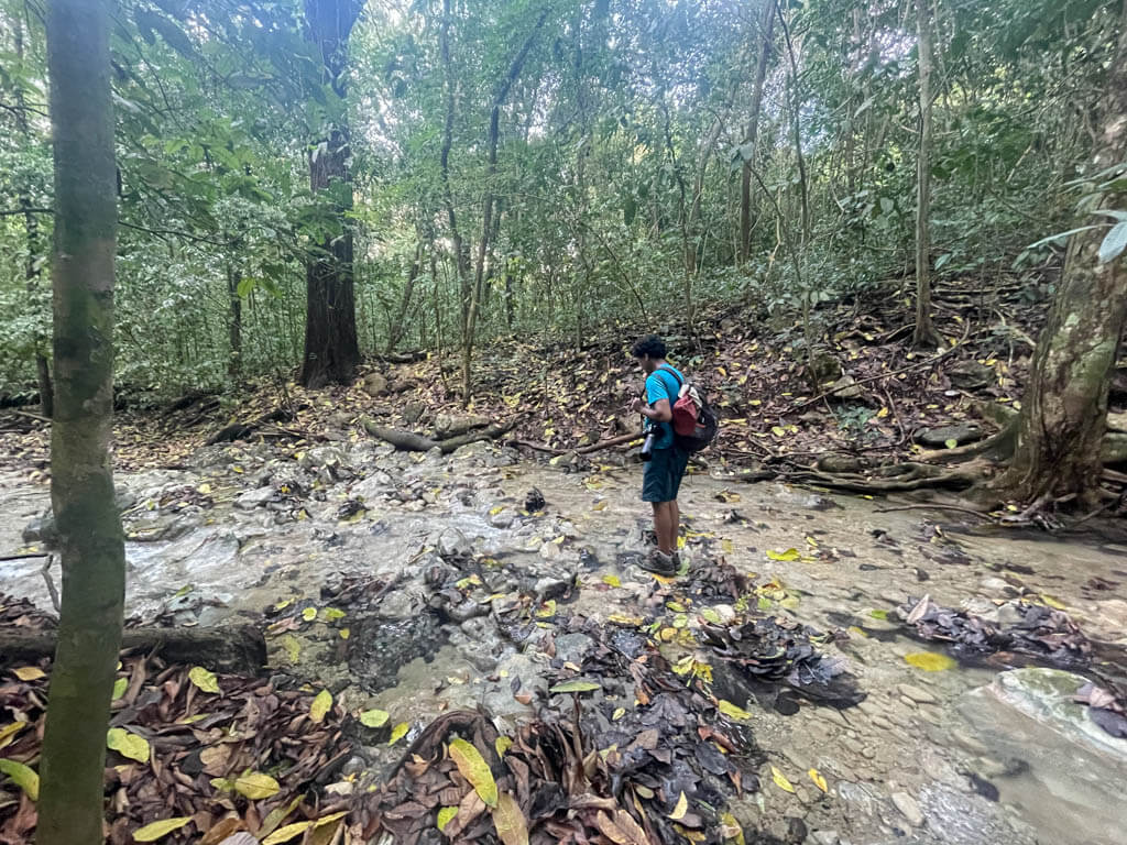
We did the hike on a sunny day, but after a rainy night. So the conditions were humid which made the 10 km hike an arduous task. The flat sections of the trail had turned muddy, due to the downpour at night. Also, we crossed streams stepping on dry leaves and stones as there was no bridges. But the wildlife and the eagerness to see the Cabo Blanco beach kept us going.
The first half was mostly uphill with some flat sections. The forest is thin in most parts near the trail so the well-placed arrow signs on wooden boards gave the confidence that we were on the right path.
The later part is mostly downhill as it gets closer to the beach. There are parts where the concrete stairs are installed similar to the Danes trail. However, those were steep and slippery due to rains, and we could understand why there were ropes installed in these sections for support.
You will hear the ocean roaring as you approach the last kilometer.
There are small signs after each kilometer. If you do not look for the signs, you may miss them, as the yellow signs on brown boards blend in with the yellow leaves on the dirt paths. The last bit was probably the easiest as we were so happy that we could make it and finally get to the beach last accessible beach on this side of the Nicoya peninsula.
Wildlife
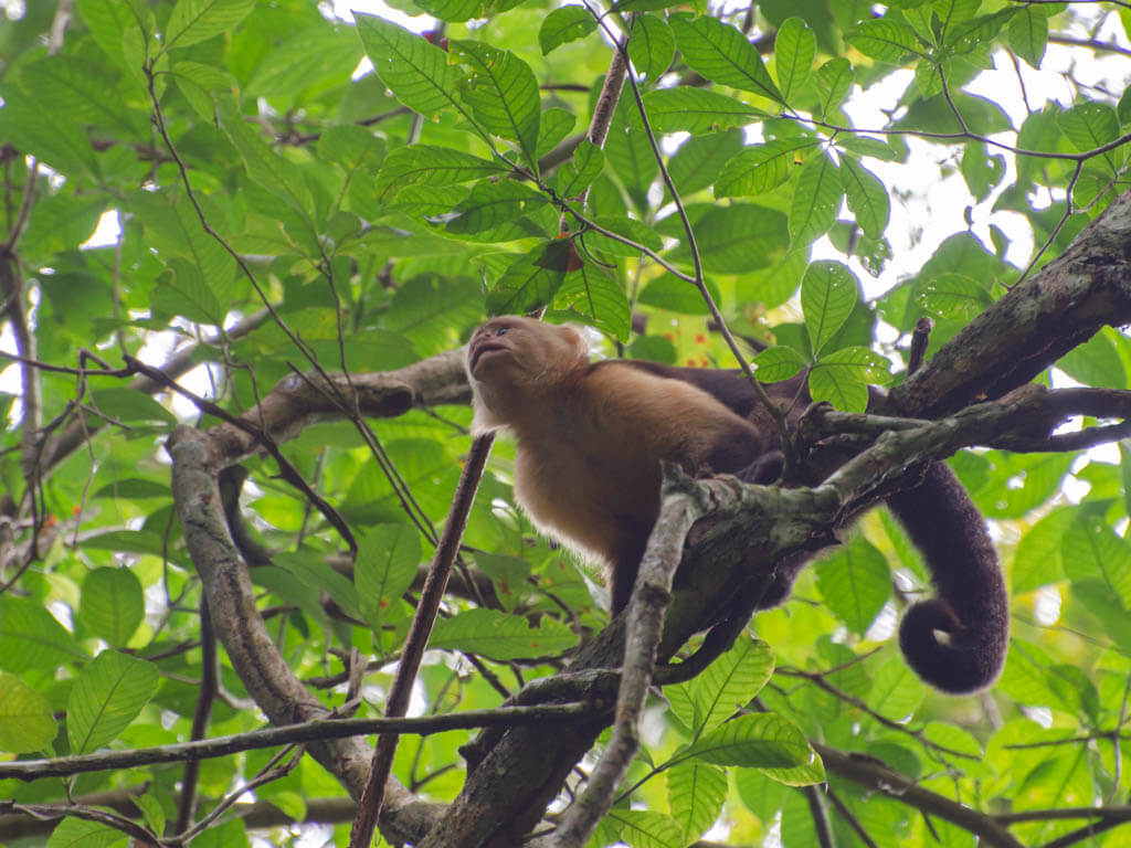
We encountered a group of mischievous capuchins on the way. While we stopped to get some photographs, some small branches started falling around us. We do not know if the capuchins did that on purpose or this naturally happened. But we decided to walk away (or flee?) from there.
There were coatis, who were oblivious to our presence and roamed casually looking for food. We found a group of howler monkeys, coati, several species of birds including a loud woodpecker on our way.
Cabo Blanco Beach
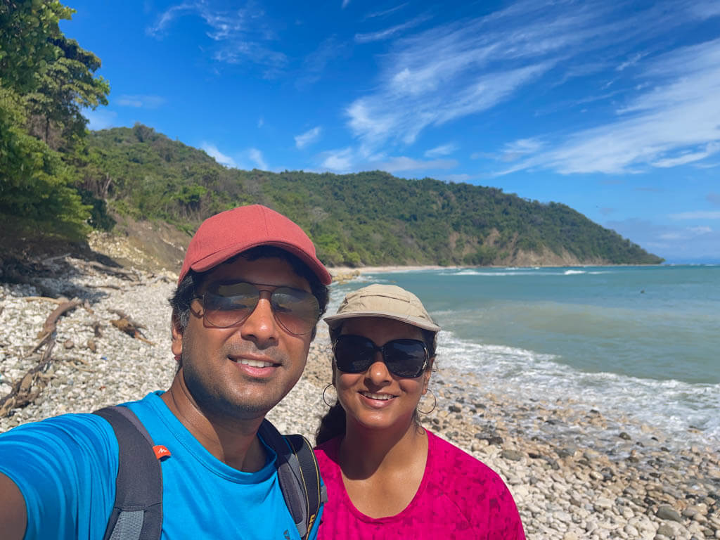
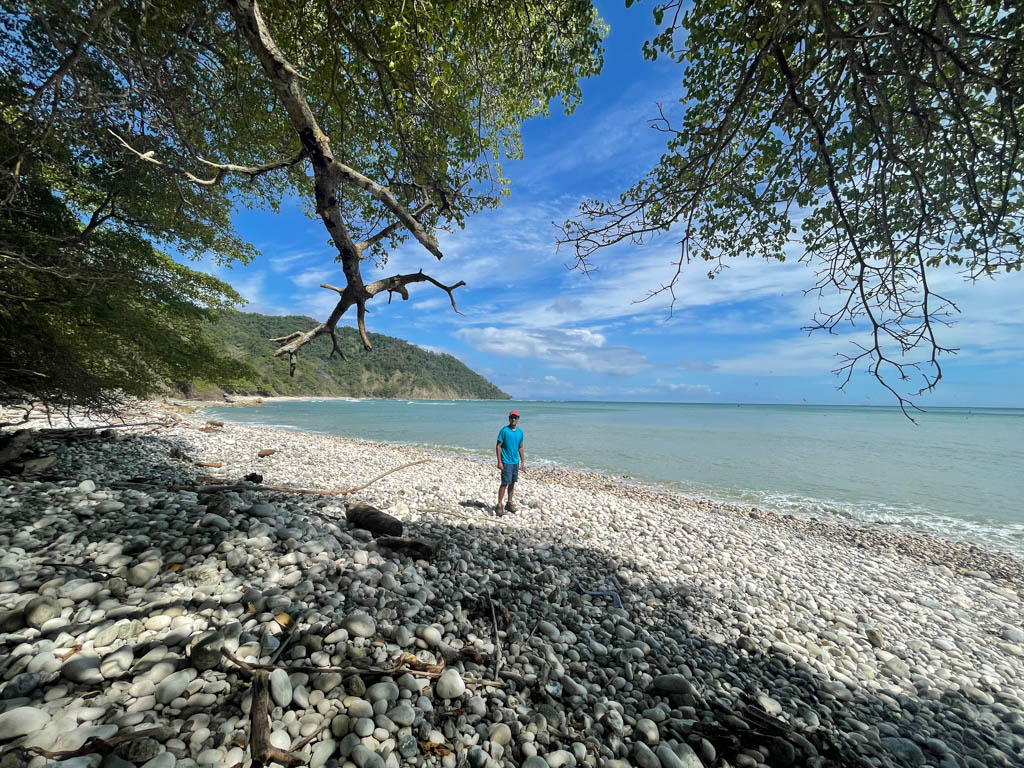
At the end of the exhausting hike, we were happy to see the long stretch of the Cabo Blanco beach. The beach is a mix of white sand and large roundish stones. Wherever you look, you will find the beach disappearing in the dense forest.
There is an open shower area to clean up after a swim. Also, there are tables and benches if you want to have some snacks. We highly recommend to carry food and water, but remember to collect your trash and bring it back.
There were aquatic birds swarming the ocean looking for food. The pelicans, boobies and terns took their turns to plunge into the water.
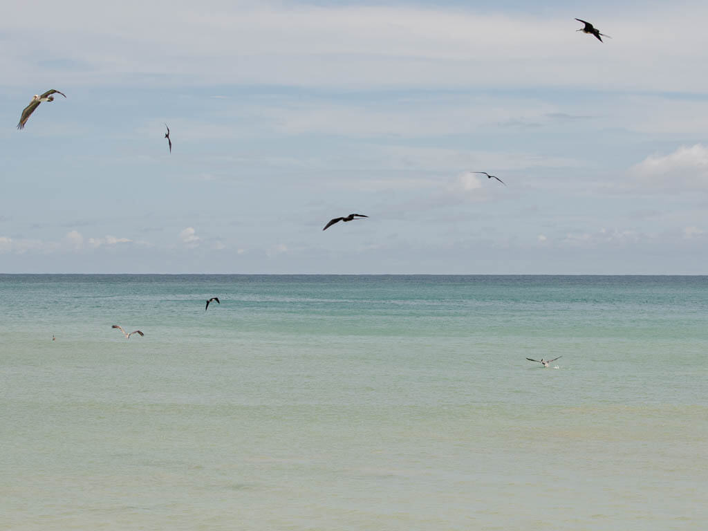
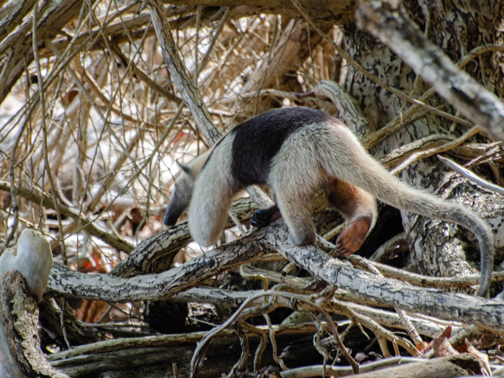
We occupied one of the tables to relax and watched the birds busy with their chores. Not just the birds, we had more living beings for company. An anteater was roaming around near our table.
We had spent about an hour before starting our hike back to the entrance, wishing that we had more time to spend.
Arboretum Trail
The third trail, Arboretum, is the smallest one and targeted towards toddlers and senior citizens to experience the reserve. The trail is 1 km long and can be covered in about 45 minutes to 1 hour.
Playa Cuevas (through Malpais town)
Playa Cuevas is a tiny pretty beach located at the end of the Malpais town. This is the only part of the Cabo Blanco Absolute Natural Reserve that is accessible directly from Malpais.
If you are driving, you will have to take a left at the end of the main road that goes through the Mal Pais. The last part of the road is narrow and bit hidden but you can check with the locals, just to confirm if you are on the right path.
There is a small open area for parking. You will have to walk few meters on a trail, before you see the beach.
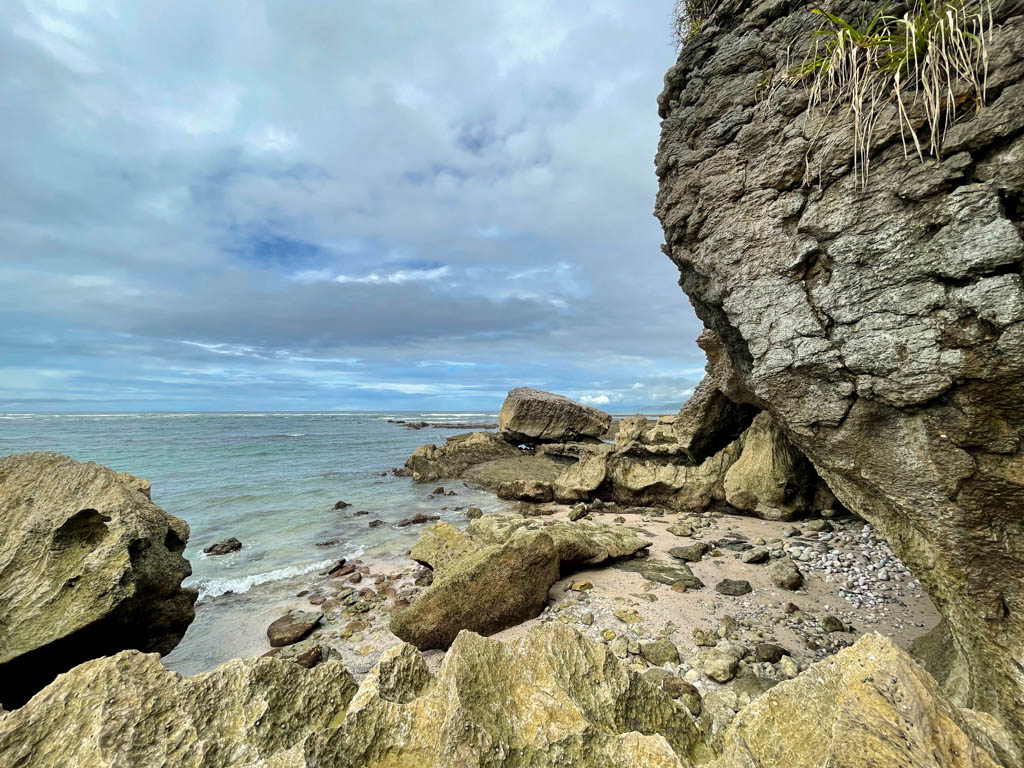
One end of the beach has cave-like formations created by erosions of huge rocks over years. The clear water is good for a dip as well.
Tips for hiking in the Natural Reserve
The Danes or the Arboretum are relatively easier trails and will take between 1 to 2 hours. These trails do not need a lot of planning.
But if you are planning to hike the Sueco trail, it definitely needs bit of planning. Two important things to remember before we move to ‘what to wear and carry’:
- Start as early as possible in the morning when the weather is the coolest
- Do not give up, the views are rewarding. But, take it easy.
What to wear
If you are visiting during the peak season, between mid-December to April, the weather will be hot and humid. However, the Costa Rica weather is unpredictable and you can expect rains anytime of the year. So you need to pack accordingly.
- Good hiking shoes (if you are doing the difficult Sueco Trail, then absolutely necessary)
- Light cotton or dry-fit comfortable clothes to beat the heat
- Swim wear (for the Cabo Blanco beach)
- Rain jacket or poncho (just in case)
What to carry
If you are planning to go for the longer hike to the Cabo Blanco beach, then these are absolutely necessary.
- Water, carry plenty.
- Snacks – reward yourself at the end of the hike.
- Insect repellent cream
- Towels (for the beach)
Final Thoughts
If you wish to get lost in a faraway hidden beach or discover the wildlife and vegetation in Costa Rica’s first natural reserve, then Cabo Blanco Absolute Natural Reserve has kept them protected, waiting for you to discover them.
If you are looking for more activities in the Cabuya Montezuma area, check our post on Montezuma Waterfalls and our Montezuma Travel Guide.
Like the post? Pin it!


We had to ‘migrate’ to Costa Rica from Honduras after Hurricane Mitch many years ago. It was truly amazing how well local people treated the natural treasures. In Honduras, they had no regard for those gems. Hence, Costa Rica has been a paradise on earth forever. Nevertheless, I haven’t been to the Cabo Blanco reserve but will certainly visit if I ever have the chance to go back.
Totally agree Renata. The people in Costa Rica truly value the wealth of nature.
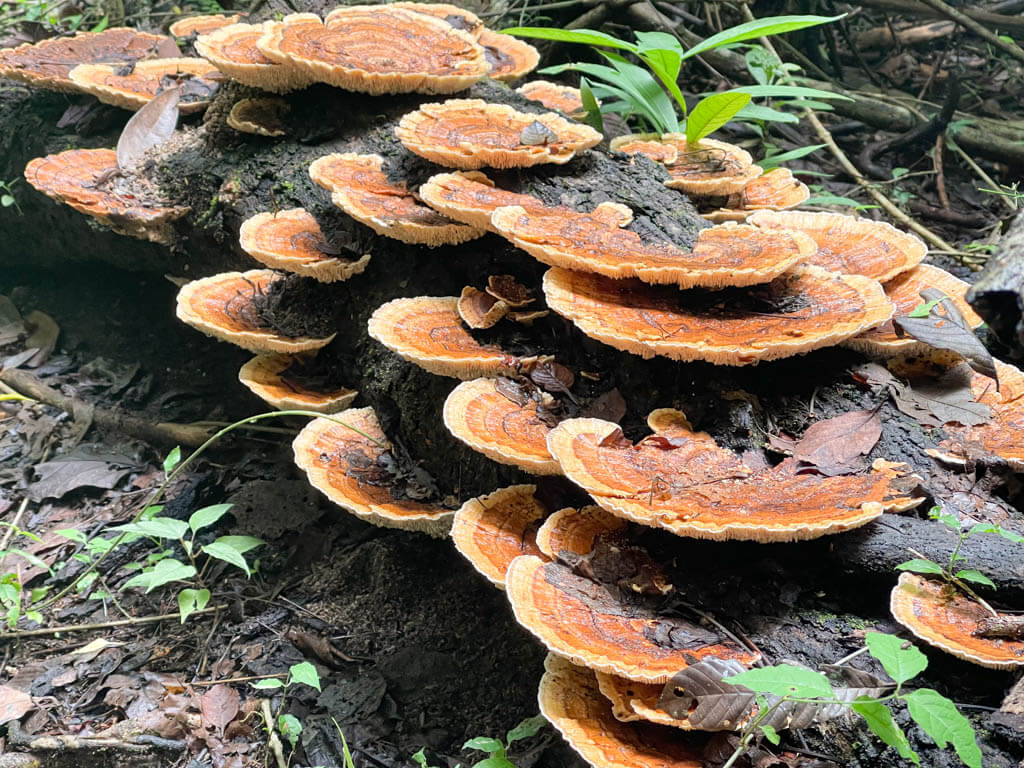
I love that picture of the mushroom family at the Cabo Blanco Natural Preserve. Everything looks so pristine and natural.
Thanks Carol. Yes, it was amazing.
When I went to Costa Rica I went on a Monkey boat tour in Jaco! Costa Rica is defiantly something different. Your photos are great and really make me wanna go back! Great article.
Thanks Stephanie.
What a gorgeous hike, and your photos make me feel as if I tagged along with you! I think I would squeal if I saw an anteater just hanging out like that. Wow!
Haha, thanks Sage.
Thank you for this post. Cost Rica is on my bucket list and this will be a great guide.
Thanks Amy. Hope you get to check Costa Rica off your bucket list soon 🙂